To understand history, F1RST understand rivers.

The drawing of the Grinter Ferry over the Kaw River hangs in the Grinter House Museum.
This drawing was given to the late Mr. and Mrs. Harry Hansen, owners of Grinter House at that time,
by Gordon and Barbara Kensler. Kansan photo by J. Bradley Burgess.
Jun 29, 1986 ... "The Chouteau Ferry," also known as "The Cook" and "The Campbell,"
was about a mile above the "Keeler Ferry" (directly south of ...
www.kckpl.lib.ks.us/kscoll/lochist/.../TN62.htm - Cached - Similar
From 1854 to 1857 other ferries were built along the Kaw River. Including the Grinter Ferry, there were
at least eleven ferries between the mouth of the river and the western boundaries of Wyandotte County.
These included the Wyandot National Ferry; the Silas Armstrong Ferry;
the Willis Wills Ferry, near the river’smouth; the Santa Fe Road Ferry; the Eureka Ferry;
the Muncie Ferry, near the present town of Muncie; the Tooley Ferry and Keeler Ferries,
approximately two miles west of the Grinter Ferry; the Chouteau Ferry, near Edwardsville;
and the Tiblow Ferry, near Bonner Springs.

This Wiki is licensed
CC-BY-NC-SA - Creative Commons
Attribution-Noncommercial-Share Alike 3.0 License. Authors, learn more about your rights.

-
... of the mighty Kaw (Kansas) River, stopping at the
Chouteau Ferry Crossing.
... and heritage of the Monticello Community in Johnson County,
Kansas.
...www.monticelloks.org/history.htm -
Cached
- [PDF]
File Format: PDF/Adobe Acrobat -
Quick ViewRiver Valley near what is now the town of Council Grove,
Kansas.10
..... approximately two miles west of the Grinter Ferry; the
Chouteau Ferry, near
...www.kckps.org/disthistory/publications/...shutt/Chapter%201.pdf
(
Note: The transcriber of this thesis has added numerous URLs from the Internet in an attempt to
provide you with additional sites for related research.)
- [PDF]
File Format: PDF/Adobe Acrobat -
Quick ViewMap Project PO Box 10922 Shawnee Mission,
KS 66225-9022
.... 1828 ::
Chouteau Ferry below West Mission Creek
... Kansas American Native Genealogy .
...minnesotafuturist.pbworks.com/f/KCAHTA-History-Map_9309pm.pdf
-
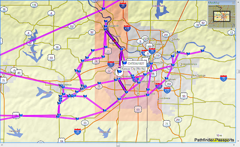
... CHOUTEAU 1827 CHOUTEAU Ferry 256.340 2010-08-21T20:56:00Z ZARAH ZARAH . ...
futurethought.pbworks.com/.../FNHA_KVHA-MCHS_OCTA-SFTA_Routes-X824p2.gpx
Camp Naish (HOAC-BSA) GeoScouting-GeoVenturing SideBar:
Our Freedom’s Frontier National Heritage Area (Port of Shawnee River Recreation Area)
was influenced by a Monticello Township Wikipedia article …

We hatched it during our Shawnee Area Chamber of Commerce (SACC) Shawnee-150 commemoration events (2005-2006) …
It guided ongoing Monticello Community Historical Society (MCHS) interpretive map displays and USD 232 educational events. As acting Clear Creek Watershed marshal from Monticello Township (Willow Ridge Subdivision), I adapted KVHA’s “Caring for the Kaw” (1997) guidelines to advocate AGR-iTourism/Geotourism destinations along our FHWA/KDOT “Prairie Passage in Kansas” with ASLA’s Fred Markham (2004-2005).
What follows began with my Kan-Ed Network Tech-Rich Classroom Blogspot about Chisholm Trail’s
“Cowskin Creek Crossing” near Colwich, KS: http://geoventuring-lnt.blogspot.com/2005/10/cowskin-creek-subwatershed-orthoview.html
[1] During mid-2005, KDOT published Fred Markham’s “Praire Passage in Kansas” I-35 corridor map about natural history adventuring …
[2] Google’s Engineering Director (Brian McClendon) added a Google Maps “Terrain View”
to help overcome Kanza Territory “Elevation Awareness Deficiency” … It leveraged our KELP Class 6-2005
“Ridges of Leavenworth County” mobile display on KDHE-KWO public health/water quality issues ....
[3] Brian McClendon also added Picasa Web photo album geo-tagging. His “High-TEK” help enabled
HINU-KVHAdventuring & OCTA-PNTS-SFTA crews to cultivate a shared sense of imagination & place!
[4] Google advocated & co-funded this Indigenous Mapping Network: http://indigenousmapping.net/
[5] Haskell Indian Nation University (HINU) students usually get KU-GISday recognition for outstanding student paper presentations …
[6] Garmin’s MapSource TOPO USA product embedded GPX-KML data exchange options to effectively interface with Google Earth (GE)
[7] NatGeoMaps adapted Kanzana Creative Commons (cc) artifacts to launch this “SaaS” offering: http://support.topo.com/articles/66
[8] Our Wikinomics Eco-Futures Forum “computing innovations”
are among (LinkedIn-HETL) Enviro-Ed benchmarks to equal or exceed:
http://minnesotafuturist.pbworks.com/My+PBworks-ning+Profile …
[9] LJWorld’s WellCommons (Eco-Futures Forum) evolved from our prior initiatives: http://wellcommons.com/groups/wellness/
Comments (0)
You don't have permission to comment on this page.